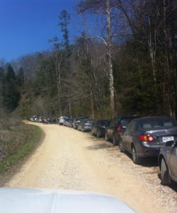
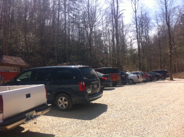
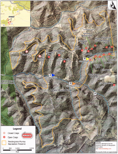
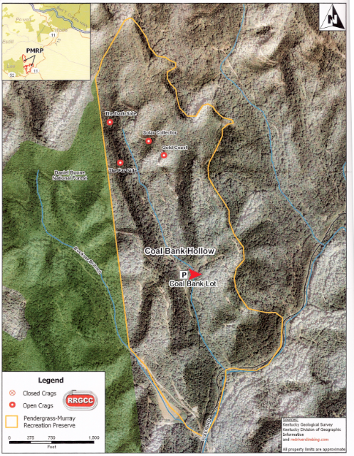
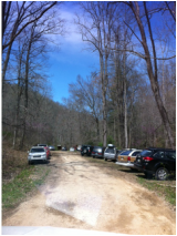
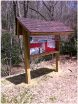
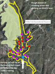
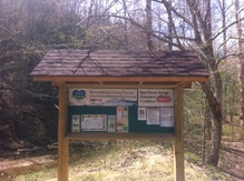
| Tourism has been working on building new informational kiosks to place in the parking areas in the Pendergrass-Murray Recreational Preserve and the new Miller Fork Recreational Preserve. These kiosks have rules of use for visitors to the area, as well as local information such as lodging, dining, and local attractions. They are still a work in progress and we hope to add more maps of the recreational areas. It was such a beautiful day on Saturday that I loaded up my parents in our old white Chevy pickup truck and headed to the kiosks. I needed to add more information to them and so we brought tacks, laminated flyers, electric drill, hammer, and super glue. We also took with us some bug spray for our ankles as ticks are already out, and wasp spray, just incase they have started to build in the kiosks. First we headed to Bald Rock road. Turns out our pickup was not 4-wheel drive and it was slow process down the huge hill into the RRGCC property. Just to be safe, 4-wheel drive is recommended if you are wanting to visit these areas. Also the speed limit is 10 mph so everyone drive slowly. What we saw at the bottom was amazing! There were cars everywhere. The first wide spot was the "Motherlode" parking area. The parking area was packed as we counted around 40 cars. Cars were also parked along the road side in every wide spot. They were from a number of states, KY, IN, OH, CO, NY, Penn, NM, NJ, MD, MI, and more. There were a surprising number of cars from Canada. Places like Ontario and Alberta. As we drove past, many cars parked along the side of the road heading to the first Kiosk in the new Flat Holler parking lot. We also saw a youth group of kids being guided that day. There were around 12 kids and they looked to be middle school age. The adults were climbing guides and everyone had bright smiles for us as we passed by. We made it to the Flat Holler Parking Lot and the first kiosk. This lot was also full with around 20 cars parked here. The neat thing about our kiosks is that they are different colors. This way if there is an emergency then you can identify which color kiosk is closest to you and the responders will have a better idea of where you are located. We are working with the Ambulance Service on identifying the color kiosks on their maps. This one at Flat Holler is bright orange. The yellow kiosk is at the Sore Heel Trail head but we couldn't get to it so I'll have to go back down there this week to fix that one. This is a very important location as this is the trail head for 12 climbing locations in the PMRP. It is also the hardest to get to. There is a hiking trail you can also take from the main road. The next kiosk is the blue one and it is located further down on the left at the Drive By / Bob Marley Parking Area. There were over 20 cars parked here also. As we were tacking up information, a young family was heading to their cars. There was two kids and they both had their hiking backpack on as they were carrying their own gear. It was a surprise to me how this rock climbing sport is growing for families and kids. As we continue along our adventure, we came to a few creek crossings as we traveled north along Bald Rock/Fixer Rd. Someone before us had lost a piece of their car in the creek. Dad and I pulled it out and loaded it in the back of the truck. As we drive north toward Coal Bank, I am reminded that this area was once full of people who lived here and worked in the coal and oil fields. A community of tent camps, buggies pulled by mule, and even a story of a hanging done at a huge oak tree along the road. We turned off to the left and head up the hill toward Coal Bank. We did loose traction a time or two but made it up. This lot was also full with around 18 cars. The Red Kiosk is here. As we were heading back out, we meet a car who was driving up the rough spot. They had momentum on their side as we backed the truck up so they wouldn't have to stop on the hill. Be careful driving around these areas as there are blind hills and you never know when a car will be coming. The only one left is in the Miller Fork Recreational Preserve, with is 300 more acres located closer to Beattyville. It is where Hell Creek and Miller Creek Converge. You have to take Shoemaker road to Hell Creek Road then turn back north and follow Miller Creek to this parking area. I have to give a big thumbs up to the Lee County Road Department. Hell Creek Road had new gravel on it and they had also cleaned out the ditch line. Miller Fork is very interesting. The road follows the creek and along the way we saw 3 broken beaver dams where they had been washed out from the flooding in March. The road was in pretty good shape as we drove back a few miles to the clearing where the new parking lot is being created. The Kiosk here is the Green one. This is also where next weekend Access Fund and the RRGCC trail days will be working most of the day Saturday, April 26th. It was beautiful weather and we enjoyed getting out. If you are curious about this area of Lee County then keep a few things in mind. First, 4-wheel drive is recommended. Second, Drive slow. Third, don't leave you trash behind. Be sure to take out what you brought in. Finally, don't be shy. Strike up a conversation with these visitors to the area. |
|
FOR IMMEDIATE RELEASE
April 17, 2014 SOAR Initiative Working Groups to Meet at Annual East Kentucky Leadership Conference Next Week; Public Invited to Join SOMERSET, Ky. – As the work of the “Shaping Our Appalachian Region”, or SOAR, initiative moves forward, citizens are invited to attend next week’s annual East Kentucky Leadership Conference in Somerset to take part in one of ten SOAR working groups. This conference will mark the first formal meetings of these working groups, which are tasked with leading large-scale discussions throughout southern and eastern Kentucky on topics related to the region’s economic future and quality of life. These ‘listening sessions’ – to take place in the spring and summer of 2014 – will be open to businesses, local governments, organizations, and all interested citizens. The information collected during these sessions will be translated into detailed strategies for moving the region forward. Together, the strategies will compose the SOAR program of work to be presented at a regional summit in November. “The SOAR working groups are our boots on the ground in this effort to revitalize and shape the future we want to enjoy in eastern Kentucky,” said Congressman Hal Rogers. “If your passion and expertise is tourism, we need your talents in that working group. If you are skilled in economic development or education, we need you to share your wisdom with those groups. We are calling on individuals from across the region who are ready to take action to help lead this initiative forward.” “Since our huge SOAR launch in December, we have worked to maintain the momentum and interest we have seen in helping this region grow and thrive,” said Governor Steve Beshear. “These ten working groups will continue to gather information and ideas, meeting with the citizens of the region over the coming months to make sure our combined efforts truly reflect the desires and recommendations of the people who live here. We cannot waste a moment, and I strongly encourage anyone with an interest in the well-being of this vital region to join us in Somerset for these first meetings.” Anyone can attend the working group meetings at no cost. While a few of the working groups have already met their capacity for formal membership, all meetings will be public and citizens are invited to attend those meetings. Working group meetings will be held on Thursday, April 24 from 1 p.m. to 3 p.m. SOAR working groups and their chairs include:
The working groups are open to businesses, local governments, organizations, and all interested citizens. The information collected during these sessions will be translated into detailed strategies for moving the region forward. Together, the strategies will compose the SOAR program of work to be presented at a regional summit in November 2014. Although participation in the working groups is free, you MUST register to attend. Please visit http://crdev.us/P3KykN to register to attend. For more information about the working groups or to inquire about membership, contact the SOAR office at 606-444-5127 or 606-437-5127. About the East Kentucky Leadership Conference In addition to the SOAR meetings at The Center, individuals are also invited to register and attend the East Kentucky Leadership Conference (EKLC). The two-day statewide conference will be held April 24-25 at The Center for Rural Development in Somerset. The Conference is designed to bring together leaders and community members from all walks of life and throughout eastern Kentucky to discuss issues important to the region, share ideas and devise solutions to problems that have kept the region from reaching its fullest potential. The conference theme, “Transforming Crisis into Opportunity”, will build upon the SOAR initiative, and will offer participants a unique opportunity to discover and develop creative solutions to problems in the region. This year, the conference features guest speakers including Congressman Hal Rogers, Governor Steve Beshear, and David C. Wilhelm, Chief Strategy Officer at Hecate Energy. Conference sessions will focus on entrepreneurship, youth engagement, work ready communities, tourism, K12 education, next generation technology and more. Register online by visiting http://www.eklf.org/ or call The Center at 606-677-6000. About the SOAR initiative The SOAR initiative was launched by Gov. Beshear and Congressman Hal Rogers late last year, after a stunning downturn in the coal market exacerbated historic challenges in Eastern Kentucky related to unemployment and poverty. More than 1,700 Kentuckians attended a one-day SOAR summit in Pikeville in December. SOAR is intended to help the region develop and put into action new locally-oriented strategies to attack those persistent challenges. The Access Fund Conservation Team will be at Miller Fork Recreational Preserve on Saturday, April 26th! Come help with projects such as building a footbridge across the creek next to the MFRP parking area, installation of signage, and trail maintenance.
Lunch will be provided for our volunteers thanks to a generous donation by SEALgrinderPT (http://sealgrinderpt.com/). Directions: from Miguel's, driving toward Beattyville on Hwy 11, take a left on Shumaker Ridge Rd, stay on it as it curves to the right (immediately after Sunrise Mountain Retreat and Angel Falls Rd and the green gate) and becomes Hell Creek Rd, then turn right (before crossing Hell Creek (there will be signs up by the trail day)) onto the road that will take you to the MFRP parking lot. GPS: 37°38'32.3"N 83°40'44.0"W Visit the Facebook event for more details. Facebook.com/RRGCC Join The Bluegrass Cycling Club for Kentucky's oldest continuously organized bicycle ride. Since 1970 the Bluegrass Cycling Club has hosted the Red River Rally.
Saturday, October 4th, 2014 Come and join our Saturday ride. Routes are 34, 42, 43 & 50 miles. The 34 & 42 mile routes are rolling and scenic with a few climbs, while the 43 & 50 mile routes are more challenging with a number of tougher climbs that take you to Furnace KY in Estill County! The 42 and 50 mile routes will have riders pedaling through Clay City KY, before crossing the Red River and rolling back up the valley. Registration begins at 11:00 a.m. at shelter #2 by the sky-lift parking lot at the Natural Bridge State Resort Park, Slade, Kentucky. Wheels roll at 1:00 PM. Sunday, October 5th, 2014 Join us in our annual celebration of the fall season! We invite you ride back in time as you climb the old logging road to the hundred plus year old historic 900-foot long Nada Tunnel, enter into the valley of the Red River Gorge where you will roll through towering cliffs and massive boulders formed seven million years ago, ride past wonders of nature Raven Rock, Chimney Top Rock and Tower Rock, as you climb your way up to Sky Bridge for a snack. Ride the ridges of Pine Ridge, past Parched Corn Creek and Zachariah.Finish the 38 mile hilly loop back at Natural Bridge or continue on to Lee County and into the charming town of Beattyville and back for the 65 mile loop. Registration begins at 8:30 a.m. at shelter #2 by the sky-lift parking lot at the Natural Bridge State Resort Park, Slade, Kentucky. Wheels roll at 10:00 AM. DirectionsFrom Lexington take I-64 east to the Mountain Parkway. Follow the parkway approximately 33 miles to the Slade exit (KY 15). Follow the signs to Natural Bridge State Resort Park (KY 11). Registration covers hot beverages prior to the ride, snacks, drinks, lunch, and sag service. Get there early! Register online through September 29th for a discount: $20 for Saturday, $25 for Sunday, or $40 for the whole weekend. After September 29th or onsite registration: $25 for Saturday, $30 for Sunday, or $50 for the whole weekend. * REFUNDS: There are no refunds for the RRR. Food!!! Saturday All the routes will have a rest stop in Stanton, KY with water, energy drinks, and snacks. When you return to the park on Saturday, you will be welcomed by the smell of some great food on the grill. We will have lunch, drinks, and dessert waiting for you. Sunday When you arrive for registration on Sunday, we will have some light breakfast foods. Once you hit the road, we will have a rest stop with water, energy drinks, and snacks at the top of the Sky Bridge climb, 17 miles into the route. We will also have a stocked rest stop in Beattyville. Following the ride we will have a cookout at the sky lift picnic shelter from 1:00 p.m. until the last riders get in from the 65-mile loop. Non-riding family members can join us for the cook-out for a small additional fee. Wrist bands will be issued at registration. Please show your wristband to acquire lunch. Safety All riders are expected to have bicycles in good condition, to obey all traffic laws, and to ride safely and intelligently. Roads are narrow with short sight distances. These are public roads, so cars will be sharing the road with us.All riders must wear an SPSC or SNELL approved hard shell helmet. A headlight or flashlight is necessary in Nada Tunnel. Please walk your bicycle through the tunnel! The road surface is wet and dangerous. Weather A cool, wet morning and a mild afternoon are usual, but not promised. The rally will go rain or shine. Dress appropriately in layers. Red River Rally Registration Saturday, October 4th, 2014 Natural Bridge State Resort Park, Slade, KY - Registration opens at 11:00AM, wheels roll at 1:00PM. Sunday, October 5th, 2014 Natural Bridge State Resort Park, Slade, KY - Registration opens at 8:30AM, wheels roll at 10:00PM TerrainA hilly 38 mile loop with one major climb or a hilly 65 mile loop with several major climbs. (Check out the slightly scary route profiles below.) Riders on 65 mile loop must be at the 26 mile checkpoint by 1:00 p.m. Descents can be wet and slippery, especially after Nada Tunnel. |
AuthorDedra Brandenburg Archives
September 2023
Categories |
 RSS Feed